


Page to showcase a series of maps from my modest Antique Map collection, maps will be added as and when I have the time! Click on the maps to go to the corresponding blog entry.
First Map is a map of the world by Herman Moll, published 1739:

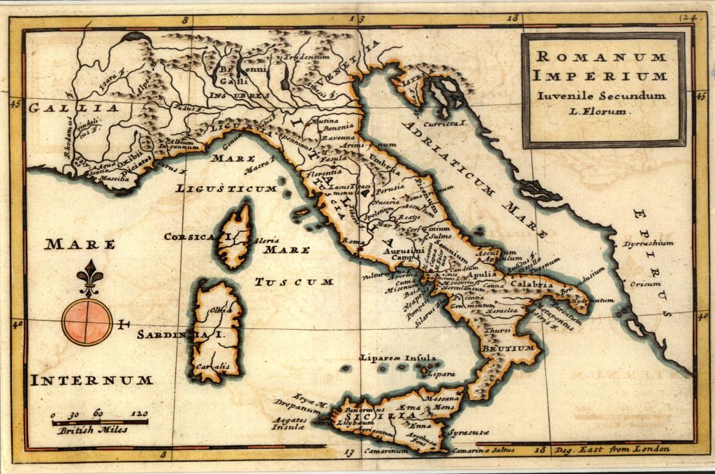
The second map, of Italy, is from the same volume, also published 1739:
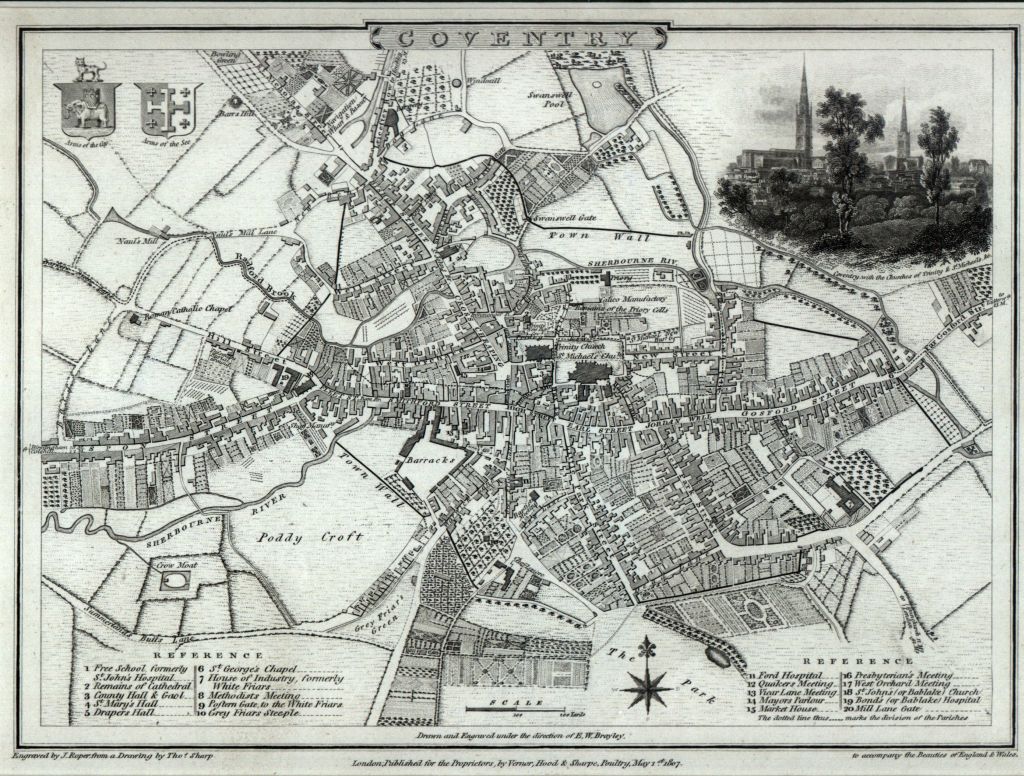
Coventry 1807 by Cole and Roper:
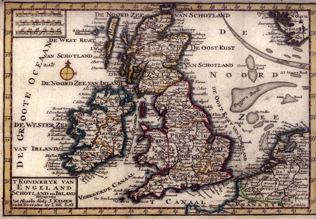
Britain 1740, Kazier and de Lat:
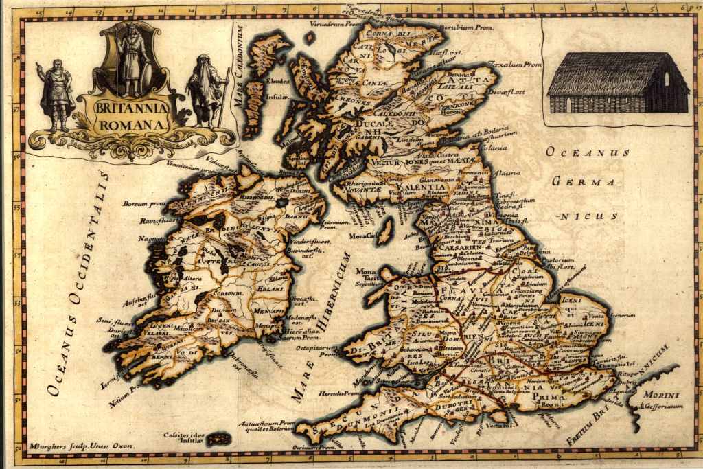
Britain 1731, Thomas Cox:
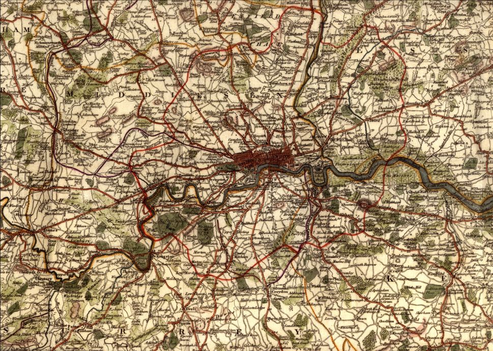
London 1808, J. Russel:
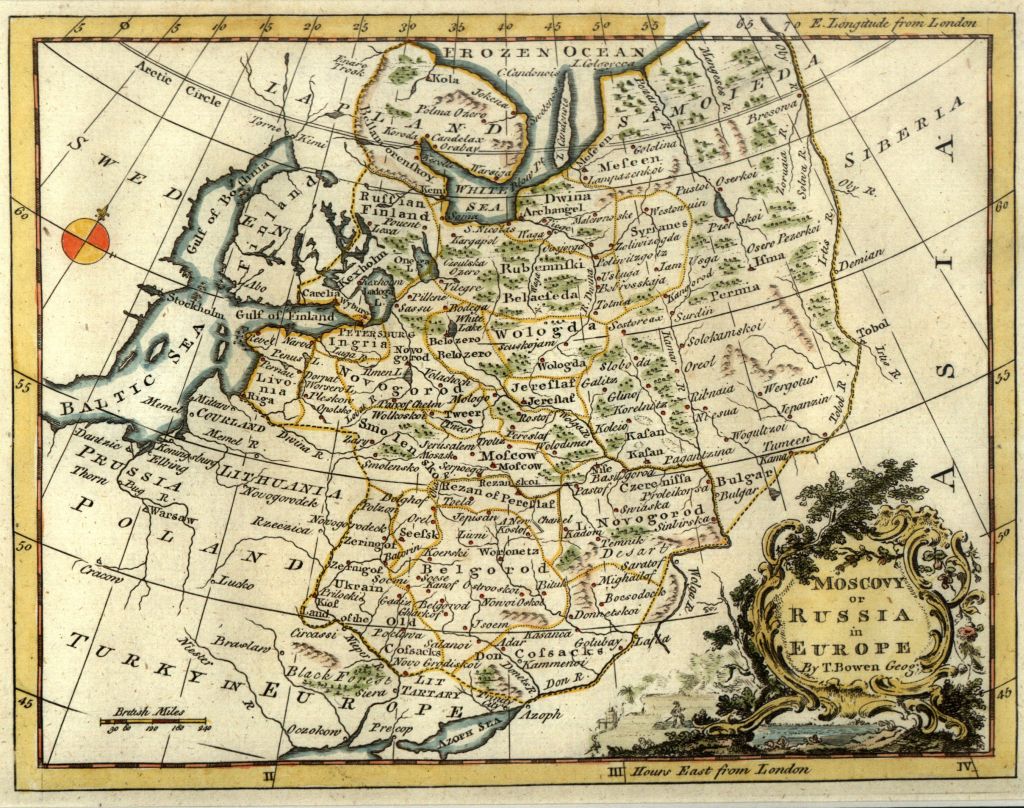
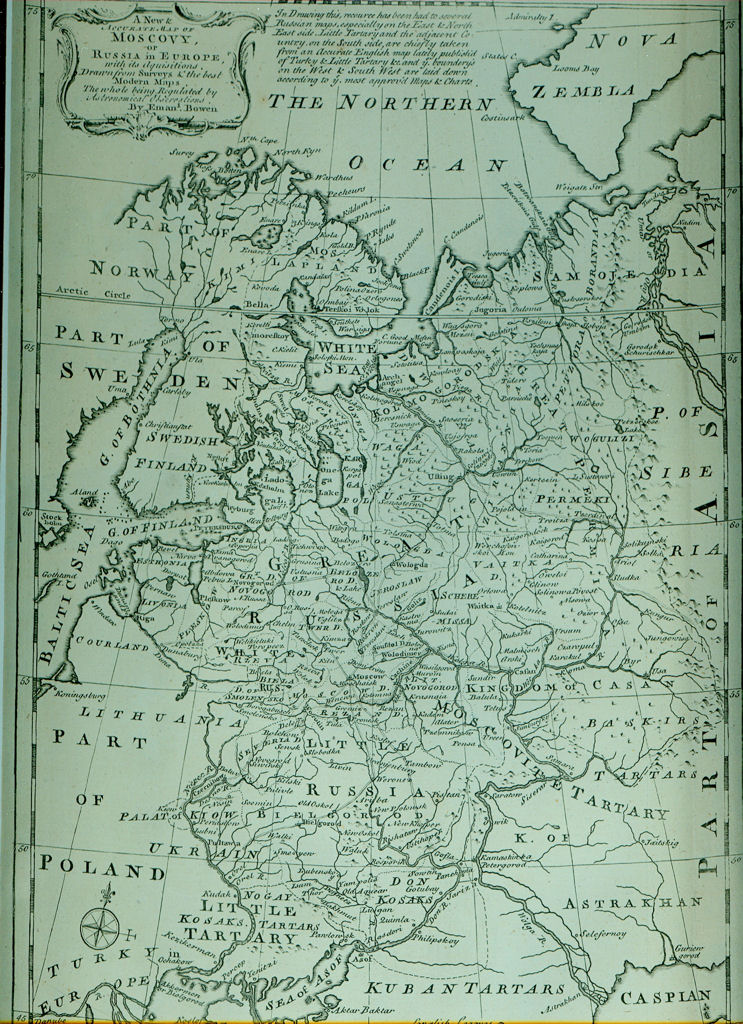
Russia 1779, T. Bowen:
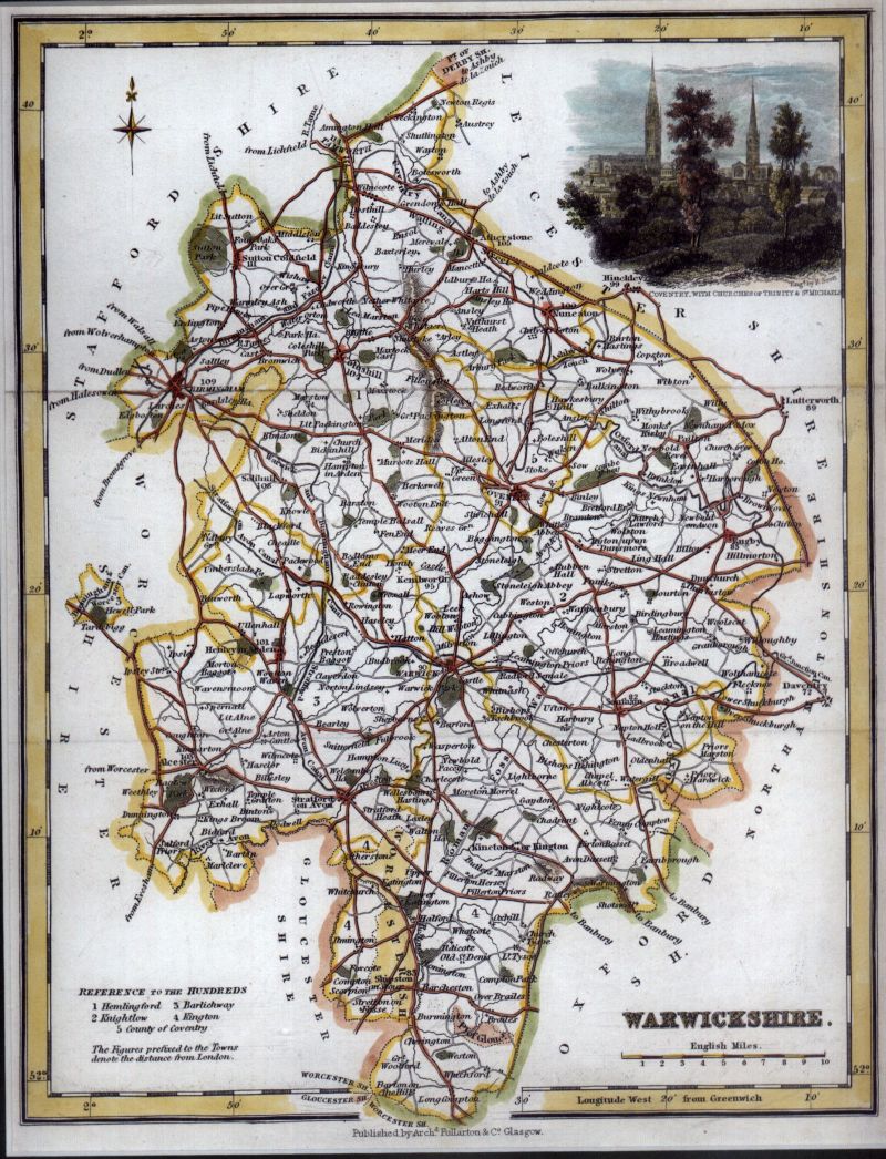
Warwickshire 1848, A. Fullerton:
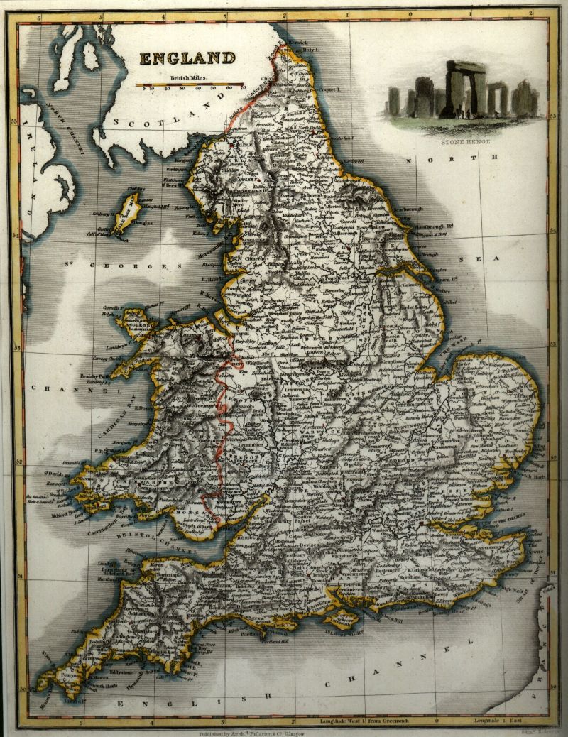
England 1839, A. Fullerton:
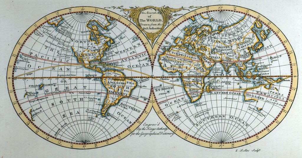
World 1760, G. Rollos:
Scotland 1838, A. Reid:
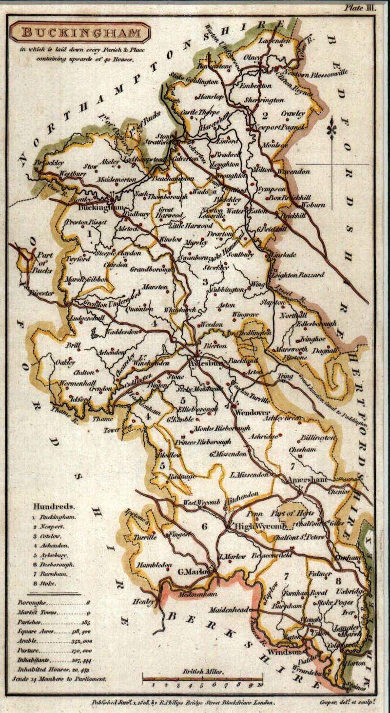
Buckinghamshire 1813, B. P. Capper:
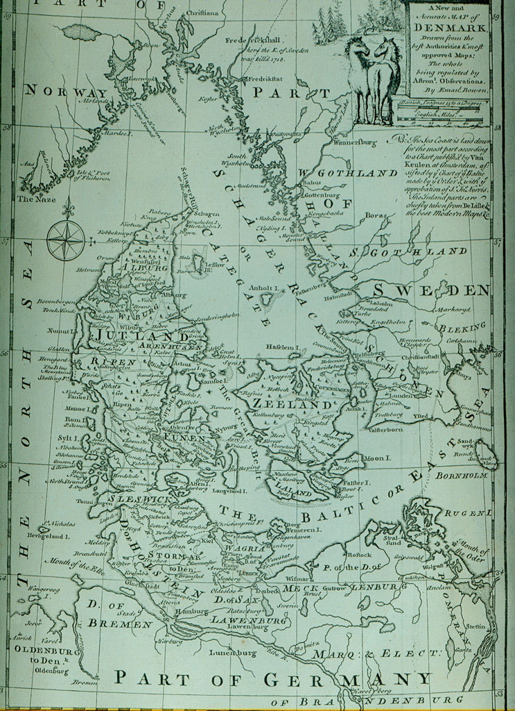
Denmark 1767, Emanuel Bowen:
Russia 1767, Emanuel Bowen:
Related posts:
- Emanuel Bowen: Russia 1767A continuing series of posts to highlight my small antique map collection (after a bit of a hiatus). All scans are taken directly from an original copy, not a reproduction. Map of Denmark taken from Emanuel Bowen’s “A Complete System of Geography”, first published in 1747, but shop I bought this from claimed it was 1767 ...
- Emanuel Bowen: Denmark 1767A continuing series of posts to highlight my small antique map collection (after a bit of a hiatus). All scans are taken directly from an original copy, not a reproduction. Map of Denmark taken from Emanuel Bowen’s “A Complete System of Geography”, first published in 1747, but shop I bought this from claimed it was 1767 ...
- Benjamin Pitts Capper: Buckinghamshire 1813A continuing series of posts to highlight my small antique map collection (after a bit of a hiatus). All scans are taken directly from an original copy, not a reproduction. Map of Buckinghamshire taken from B.P. Capper’s “A Topographical Dictionary of the United Kingdom” published in 1813. Explore the map below using Magic Toolbox‘s excellent plugin .. Watch ...
- Alexander Reid: Scotland 1838A continuing series of posts to highlight my small antique map collection (after a bit of a hiatus). All scans are taken directly from an original copy, not a reproduction. Map of Scotland taken from Alexander Reid’s “Atlas of Modern Geography” published by Oliver and Boyd in Edinburgh 1838. Explore the map below using Magic Toolbox‘s excellent ...
- Updates and MusingsThis is a quick post that isn’t really designed to be read, but is to collect my thoughts about what jobs need to be done around my various web presences such as updating, tidying up, general procrastination as well as maybe other projects that have fallen by the wayside that need to be picked up again. ...
- George Rollos: World 1760The latest addition to my collection, another world map from the Pickwick Gallery in Stratford-Upon-Avon from where I source most of my new additions. Title “An accurate map of the world drawn from the best authorities”. This one is taken from the “Geographical Dictionary”, 1760, engraved by George Rollos and as far as I can ascertain ...
- Fullerton: England 1839A continuing series of posts to highlight my small antique map collection. All scans are taken directlly from an original copy, not a reproduction. Map of England taken from James Bell’s “A System of Geography, Popular and Scientific, or a Physical, Political and Statistical Account of the World and its Various Divisions” published by Archibald Fullarton ...
- Fullerton: Warwickshire 1848A continuing series of posts to highlight my small antique map collection. All scans are taken directly from an original copy, not a reproduction. Map of Warwickshire from “The Parliamentary Gazetter of England and Wales” published by A. Fullerton and Co., 1848. From Berkshire Byways: Gazetteers and popular atlases were a speciality of Fullerton & Co. The ...
- Bowen: Russia 1779A continuing series of posts to highlight my small antique map collection. All scans are taken directly from an original copy, not a reproduction. Map of Russia from J. Carver’s “New Universal Traveller: Containing a Full and Distinct Account of all the Empires, Kingdoms, and States, in the Known World”, published by G. Robinson 1779. As ...
- Russell: London 1808A continuing series of posts to highlight my small antique map collection. All scans are taken directlly from an original copy, not a reproduction. Map of Britain by Thomas Cox from his “Magna Britannia” published 1731. Thomas Wright wrote in 1836: “Map of the Country Surrounding London to the extent of Thirty Miles” from Dr. Hughson’s “Description ...


