


A continuing series of posts to highlight my small antique map collection. All scans are taken directlly from an original copy, not a reproduction.
Map of Britain by Thomas Cox from his “Magna Britannia” published 1731. Thomas Wright wrote in 1836:
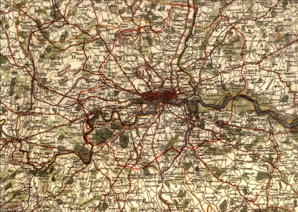
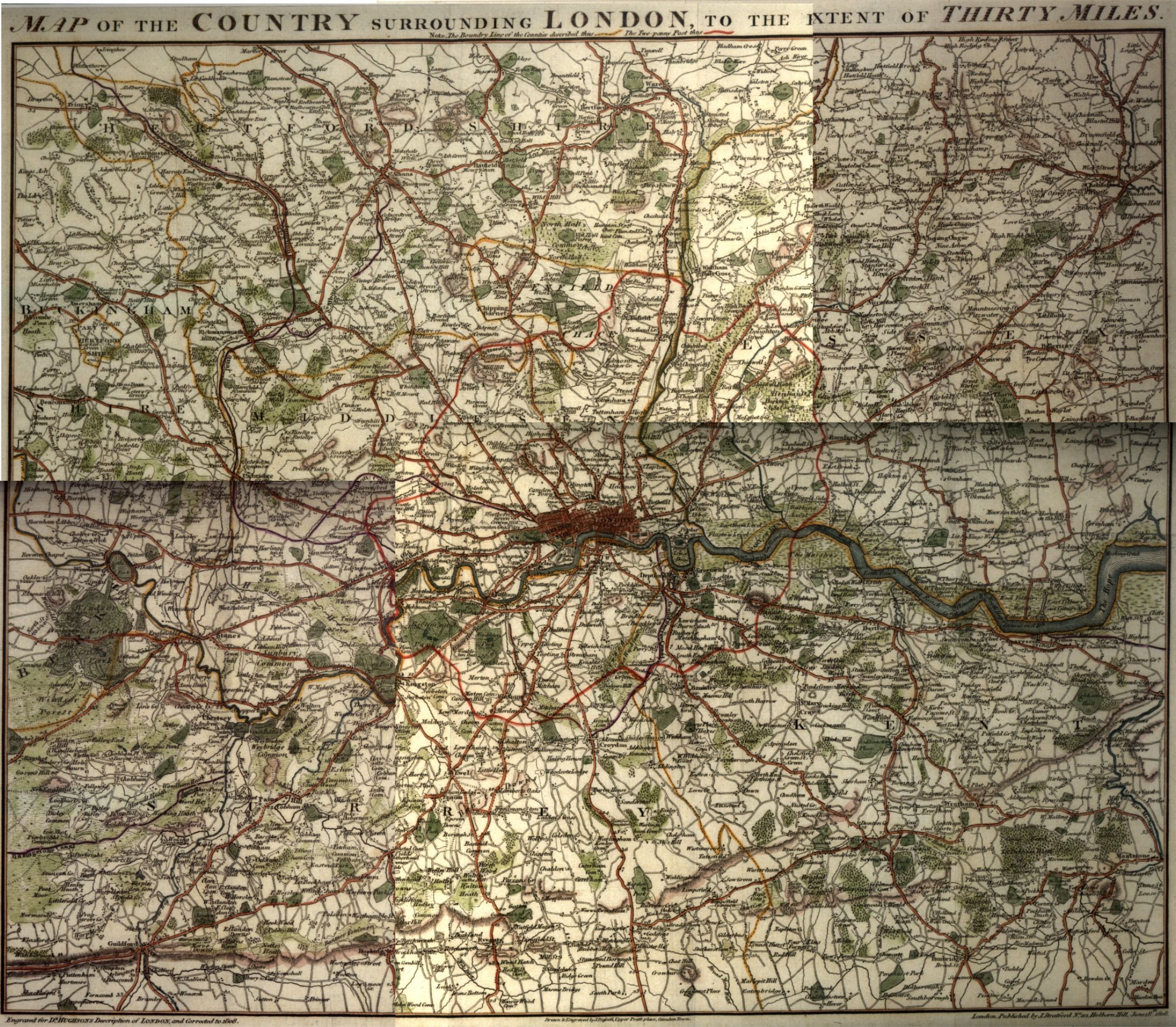
“Map of the Country Surrounding London to the extent of Thirty Miles” from Dr. Hughson’s “Description of London” published by J. Stratford, 1808, drawn and engraved by J. Russel (above is detail from the centre of the map). The red line denotes the extent of the ‘Twopenny post’ district of London. The dark and light patches in the full map below are due to the map being scanned in four parts.
As far as I can tell this is from a series of 6 volumes of “London: Being an Accurate History and Description of the British Metropolis and its Neighbourhood, to thirty miles extent, from an actual perambulation.” Volume 5 is from 1808. The texts can be found on Google Books, volume 5 direct link here.
Explore the maps below using Magic Toolbox‘s excellent plugin

..
Watch out for the next map in this series..


