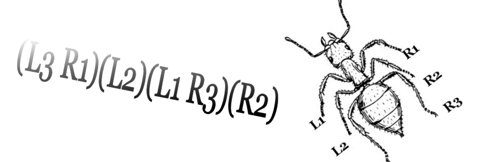
Keizer and de Lat: Britain 1740

A continuing series of posts to highlight my small antique map collection. All scans are taken directlly from an original copy, not a reproduction. Other than knowing that this was published in 1740 by J. Keizer and I. de Lat, and that they were Dutch, I know very little more about this one. From an item on the Christie’s web…

More…

Cole and Roper: Coventry 1807

A continuing series of posts to highlight my small antique map collection. All scans are taken directlly from an original copy, not a reproduction. This third map in the series is also taken from “The British Atlas” by George Cole and John Roper published in 1810 (although the map carries the legend of 1807 at the bottom). This was a…

More…

Herman Moll: Italy 1739

A continuing series of posts to highlight my small antique map collection. Most of these maps are sourced from the Pickwick Gallery in Stratford-Upon-Avon. All scans are taken directlly from an original copy, not a reproduction. This second map in the series is also taken from Herman Moll’s “Geographica Antiqua”, 1739 (German Wikipidea entry.) Explore the map below using Magic…

More…

Herman Moll: World 1739

This is the first in a series of posts to highlight my small antique map collection. I should point out that I am by no means an expert on this topic, but know what I like and am fortunate enough to be a short journey away from the Pickwick Gallery in Stratford-Upon-Avon from where I source most of my new…

More…